
The highest village
Saint-Priest-la-Prugne lies on the north-western edge of the Loire département, where the Pays d'Urfé meets the borders of the Allier and the Puy-de-Dôme. It is the highest village of the area, set in an upland of forests, clearings and streams that the maps call the Bois Noirs, the black woods. The name fits: the dense fir and spruce plantations look dark from a distance, even on a bright day.
Life here has always been shaped by altitude and forest. Winters are longer and colder than in the valleys below, snow comes more often, and the growing season is short. For generations the inhabitants combined farming with forestry and woodwork, cutting timber, making charcoal and working the clearings for pasture.
The approach tells the story. As you climb from the valleys around Saint-Just-en-Chevalet, the hedged fields give way to steeper pastures, then to the first blocks of conifers, and finally to forest on every side. By the time you reach the village, the air is noticeably cooler and the horizon has closed in behind the trees. It feels further from the plain than the distance on the map suggests.
Forest and streams
The forests around Saint-Priest-la-Prugne are among the largest of the Loire hills. Silver fir, spruce and beech cover the slopes, with mosses, ferns and bilberries underfoot. Clearings open on to pastures and small hamlets, and forest tracks run for miles between the trees.
Several streams rise in these hills. The Besbre is said to have its source in the Bois Noirs near the village, before flowing north towards the Bourbonnais and eventually joining the Loire. Other streams drain the slopes in different directions, some towards the Allier, others east towards the Loire, because the ridge here forms part of the divide between the two rivers.
The peat bogs and wet meadows scattered through the forest are fragile places, home to particular plants and insects. Keep to paths when you come across them, and do not walk on the spongy ground, which is easily damaged.
The former uranium mine
For several decades in the second half of the twentieth century, Saint-Priest-la-Prugne was home to one of France's uranium mines. The site of Les Bois Noirs-Limouzat, in the commune, was worked from the 1950s, with ore extracted from the ground and processed on site. Mining continued until around 1980, when the operation closed.
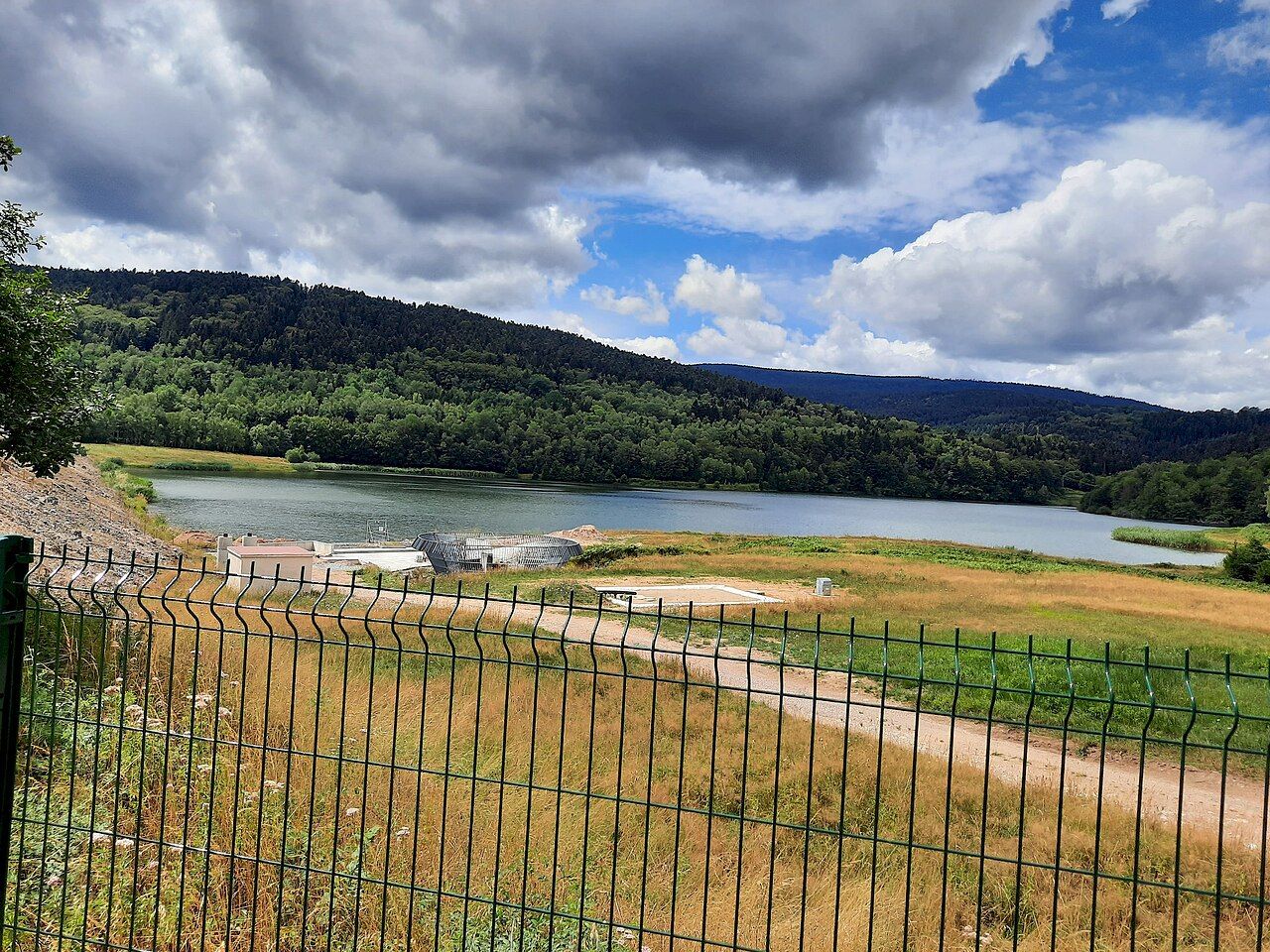
After closure the site was redeveloped. A lake now covers the former installations, held behind a dam, and the area is fenced and private. Monitoring of the site continues, as it does at other former uranium mines in France, and public information on its environmental follow-up is available from the authorities.
Turn the page: The towers of Urfé on their hill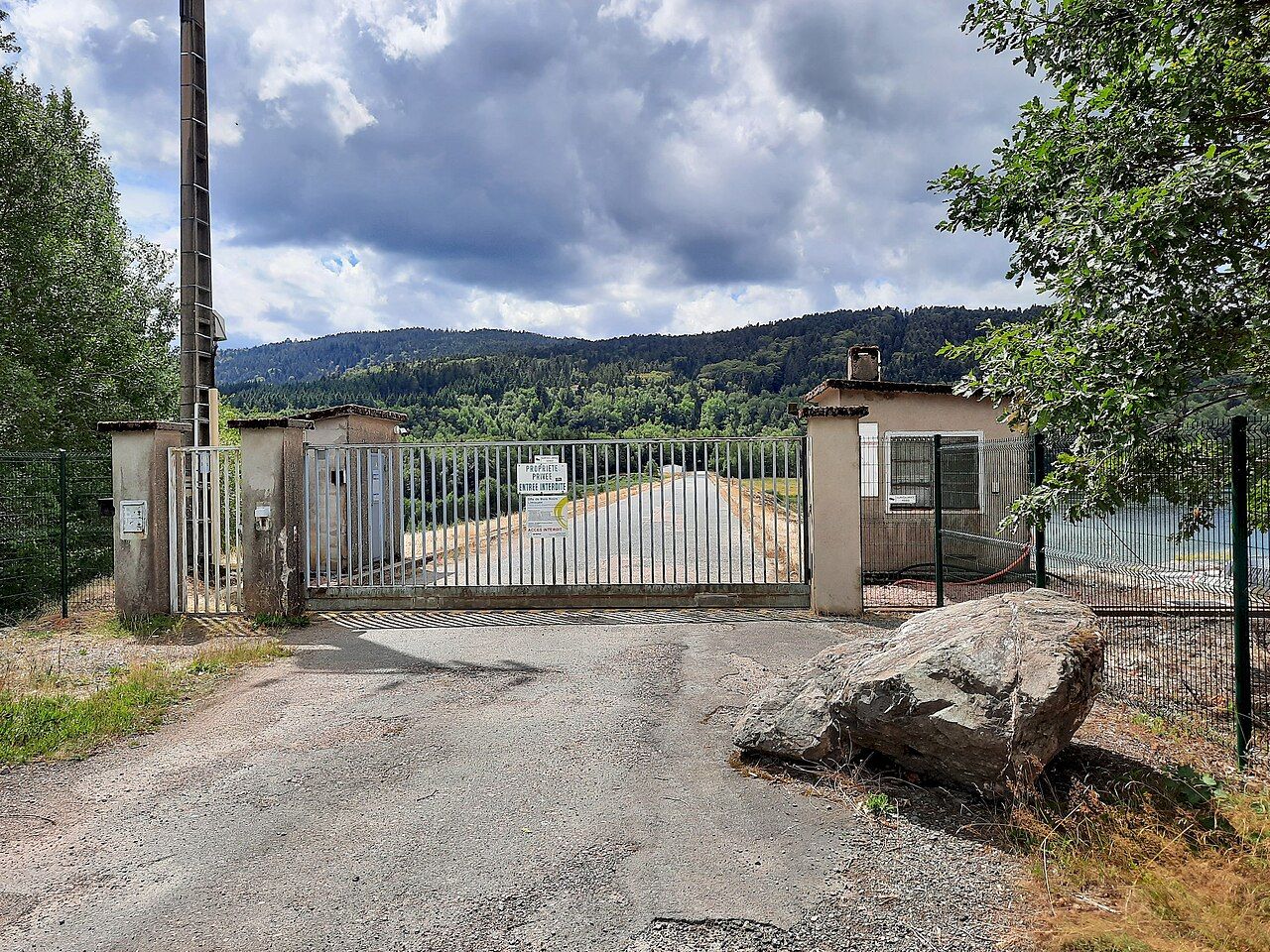
Visitors see the lake from the road, a sheet of grey water framed by the dark forest. There is no access to the site itself, and signs at the gate make clear that entry is forbidden. The mine is part of the village's history, remembered by those who worked there and the families who came for the jobs, and it is told here factually, without drama.
The village today
Today Saint-Priest-la-Prugne is a quiet upland village of a few hundred inhabitants. Its houses gather around the church and along the roads leading out into the forest, with hamlets scattered in the clearings. The pace is slow, and visitors come mainly for the forest, the walks and the fresh air of the heights.
In summer the cooler air draws walkers from the hot plains below. In autumn the woods fill with mushroom seekers and the colours of turning beeches. In winter, when snow covers the forest, the area becomes a place for snowshoes and sledges, though snow cover varies greatly from year to year.
Walking in the Bois Noirs
The forest around Saint-Priest-la-Prugne is crossed by tracks and paths, some of them part of the area's waymarked walking circuits. They lead through fir woods, across streams and up to viewpoints where the trees open on to the surrounding hills. Distances can be long and junctions many, so a good map is essential.
- Forest loops. Circuits of a few hours wind through the woods and clearings near the village.
- Ridge walks. Longer routes climb towards the high points on the borders of three départements.
- Stream valleys. Paths follow the young watercourses through the forest.
The weather can change quickly at this height. Carry warm layers and a waterproof even in summer, and be aware that fog can make the forest confusing. In the hunting season, notices are often posted at the edges of woods.
Saint-Priest-la-Prugne is reached by departmental roads through the forest, from Saint-Just-en-Chevalet to the south-east and from the Allier to the north. A car is the practical way to get here, as public transport is very limited. In winter, roads can be snowy or icy.
Services in the village are few. Bring supplies for the day, especially if you plan a long walk. Respect private property, including the fenced former mine site and the forests, which belong to a mix of public and private owners.
Saint-Priest-la-Prugne shows a different side of the Pays d'Urfé from the gentle valleys around Saint-Just: higher, darker, quieter, and marked by a stretch of industrial history that few would expect in such a remote place. For many visitors, that combination is what makes it worth the drive.