
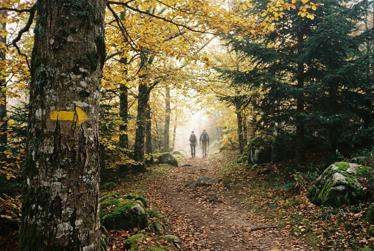
The Pays d'Urfé is walking country first and foremost. Its hills are not high enough to need mountaineering skills, but they are steep in places, thickly wooded and laced with old tracks that once linked farms, chapels and market villages. Many of those tracks now form signed loops, and once you understand how the signs work, you can string together anything from a short stroll to a long day over the ridges.
How the waymarking system works
France uses a shared set of painted marks on trees, rocks, posts and walls. Yellow stripes indicate a local walking circuit, usually a loop that starts and finishes in the same village. Red and white stripes mark the long-distance GR routes, and yellow and red together mark regional GRP routes. You will see these colours across the Loire département, so the logic you learn here works elsewhere too.
The marks follow a simple grammar:
- A single stripe means you are on the right path.
- A bent stripe or arrow means the path turns.
- A cross made of two strokes means wrong way: turn back to the last junction.
At major junctions you will often find wooden or metal signposts giving the name of the next hamlet or viewpoint and sometimes a walking time. Times are estimates for a steady pace without long stops; add a margin for photographs, picnics and steep climbs.
Lengths, climbs and difficulty
Most local loops run somewhere between a few kilometres and the length of a comfortable day, and many villages have more than one. Shorter circuits tend to stay around the village and its hamlets; longer ones climb onto the ridges or into the forests. What makes a route tiring here is rarely distance alone. The terrain rises and falls constantly, and a loop that looks modest on the map can include several sharp climbs.
Before setting off, look at the contour lines rather than just the kilometre count, and allow time for the descents, which are hard on the knees after rain when granite gravel and wet leaves become slippery. Routes are occasionally altered because of forestry work, landslips or changes of land ownership, so if the marks seem to disappear, go back to the last one you saw rather than pushing on.
Maps and route information
Carry a paper map at 1:25,000 scale, the standard for walking in France, which shows field boundaries, tracks, springs and contour lines in enough detail to follow the loops and recover if you lose the waymarks. Phone signal can be patchy in the deeper valleys and under thick forest, so a downloaded map on your phone is a good back-up but not a replacement. Local town halls and information points sometimes have leaflets describing circuits; availability changes, so ask when you arrive.
A classic day loop to the castle
Turn the page: Autumn: copper beeches, chestnuts and cepsIf you have only one day, the hill crowned by the ruins of the Château d'Urfé makes a natural objective. Starting from Champoly, tracks climb through pasture and woodland to the ruined keep and walls on the summit, where the views on a clear day stretch over the Roannais plain and towards the Forez. From there you can continue along the high ground before looping back down to the village through hamlets and fields.
Plan for a good part of the day rather than a quick dash. The castle site is a ruin; stay on the paths, keep away from unstable walls and supervise children closely.
Other good bases
Each village of the area gives a different flavour of walking. Cherier sits on high ground with long views over the Roannais, so even a short loop there brings wide horizons. Saint-Just-en-Chevalet, the market village, has several circuits that combine lanes, woods and streams. Further south and higher up, the routes around Saint-Priest-la-Prugne lead into the dark fir forests of the Bois Noirs, where the atmosphere is closer to a mountain walk, with damp hollows, peat bogs and a deep hush under the trees.
Choosing by season
Spring is the classic walking season, with broom flowering on the slopes and streams running full. Summer brings long days but can be hot on the exposed ridges; set off early and carry plenty of water. Autumn is beautiful for colours, though it is also hunting season, and winter walks are possible when the paths are clear of snow and ice.
Sharing the paths
Most circuits cross farmland and private woods, and access depends on goodwill. Close the gates you open, keep dogs on a lead near livestock and avoid trampling meadows that will be cut for hay. You may meet tractors, forestry vehicles, horses and mountain bikers on the same tracks; a greeting and a step aside go a long way.
From autumn into late winter, organised hunts take place in many communes, often at weekends and on certain weekdays. Days and arrangements vary locally. Wear something bright, keep to the waymarked path and make yourself heard if you come near a line of hunters.
Leave no litter, pick nothing that is clearly being cultivated and remember that springs are not always safe to drink from. With a map in your pocket and an eye on the yellow marks, you can spend days here without walking the same path twice.