
A commune of hamlets
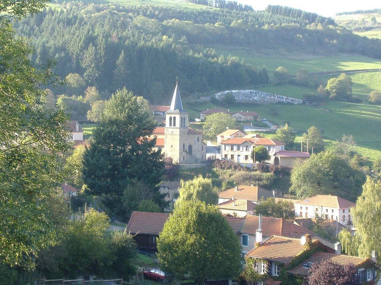
Cherier is a rural commune on the eastern slopes of the Pays d'Urfé, where the hills begin their descent towards the Roannais plain. Like many communes of the Loire uplands, it is less a single village than a scatter of hamlets, farms and houses spread over a wide area of fields, woods and small valleys. Its main bourg lies at Les Moulins, in a green valley where the church and the mairie stand among a cluster of houses.
The name Les Moulins, "the mills", recalls the water mills that once used the streams running down from the hills. Mills like these ground grain and powered small workshops across the area, and the valleys of the Pays d'Urfé still hold traces of them in the shape of old buildings, leats and weirs.
Les Moulins and its church
Seen from the slopes above, Les Moulins is a compact group of tiled roofs gathered around the church, whose square tower is topped by a slender pointed spire. Behind it the cemetery climbs the hillside, and beyond that the meadows rise to the edge of dark fir woods. The view sums up the landscape of the commune: a sheltered valley floor, steep pastures and forest on the heights.
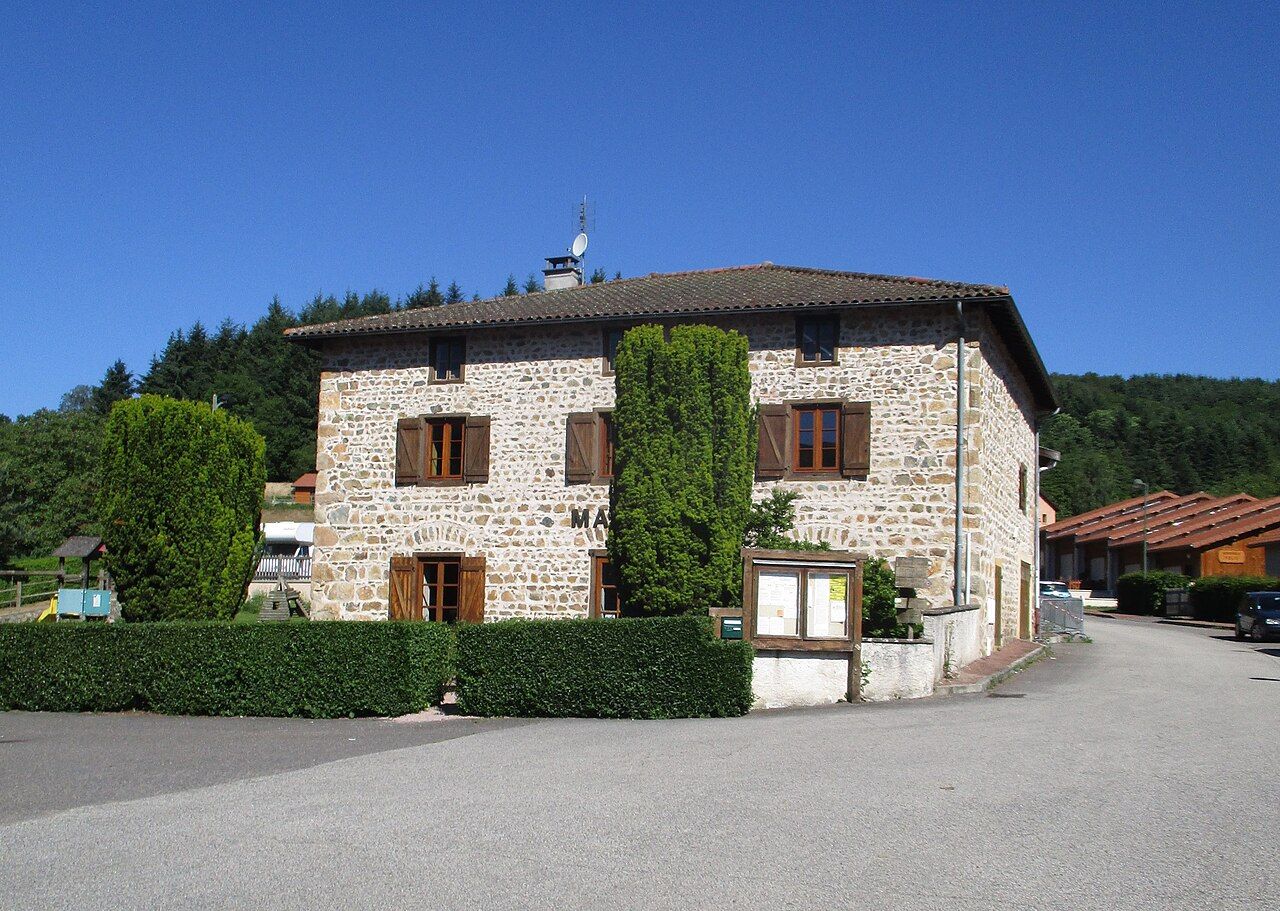
The mairie stands nearby, a solid house of rough stone with wooden shutters, its walls built of the mixed granite and rubble that gives so many buildings here their warm colour. A notice board outside carries news of local events, and it is worth a look for anything happening during your visit. Around the square, the houses are close together, with small gardens and vegetable plots squeezed into every sunny corner, a sign of how carefully the valley floor has always been used.
Granite houses and crossroads
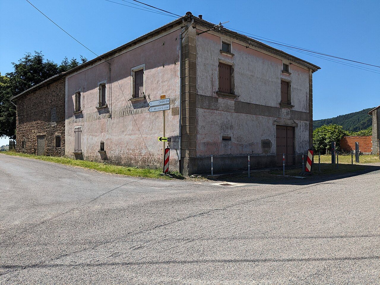
Driving or walking through Cherier, you pass old farmhouses of granite and rubble stone, many with steep roofs, wide barn doors and small windows set deep in thick walls. Some have been carefully restored, others stand empty or have been patched over the generations. Rendered houses with tall shuttered windows, often painted in pale pinks and ochres, line some of the roads, especially at crossroads where hamlets grew up around traffic.
Stone crosses stand at many junctions, and old bread ovens can be spotted beside some farms. These details of rural architecture are explored further in our guide to granite farms and stone crosses, and Cherier is a good place to look for them.
Turn the page: Saint-Just-en-Chevalet, the village where roads meetViews over the Roannais
What sets Cherier apart from some of its neighbours is the view. From the higher lanes and ridges of the commune, the land drops away to the east towards the Roannais plain, a wide basin of fields, hedges and woods where the Loire flows north past Roanne. On clear days the eye carries across the plain to the hills on the far side, with the Monts du Beaujolais said to be visible on the horizon.
The best viewpoints are not formal belvederes with signs and benches, but bends in the road, field gates and gaps in the hedges where the slope opens up. Walk or drive slowly along the upper lanes and stop where it is safe to do so. Morning light is good for the view east, while late afternoon brings warm colours to the slopes and the plain below.
Visibility changes with the weather. Summer haze can soften the horizon, while clear autumn days after rain often give the sharpest views. In winter, low cloud sometimes fills the plain while the hills stay in sunshine, and from Cherier you can look down on a sea of mist.
Walking circuits
Cherier has its share of the area's waymarked walking circuits, which follow old lanes, farm tracks and forest paths between the hamlets. They combine valleys, woods and open slopes, and several climb to the viewpoints over the Roannais. Markings at junctions guide the way, and maps of the circuits can usually be found locally.
- Valley walks. Easy routes around Les Moulins follow streams and pass old mill buildings.
- Ridge loops. Longer circuits climb through woods to the high lanes with views east.
- Linking communes. Paths continue towards neighbouring villages for a longer day.
Paths can be muddy after rain, and some climbs are steep. Wear good shoes, carry water and a waterproof, and take care in the hunting season, when notices may be posted at the edges of woods.
Spring and autumn are the most rewarding seasons. In spring the meadows are green and full of flowers, and the woods come into leaf. In autumn the beeches and oaks turn gold and copper, and the clearer air often gives the best views. Summer is pleasant for walking in the early morning or evening, when the heat eases. Winter can bring snow to the higher lanes; check conditions before driving up.
Cherier is reached by departmental roads from Saint-Just-en-Chevalet and from the Roannais. A car is the practical way to get around, as public transport in the hills is limited and timetables change. Services in the commune are few, so bring what you need for the day or stop in a larger village on the way.
Cherier rewards slow travel. Drive the small roads with no fixed plan, stop at the crossroads and the field gates, and let the view east do the rest. Down below, the town of Roanne and its plain wait for another day.
Here ends the chapter. Back to the contents.