
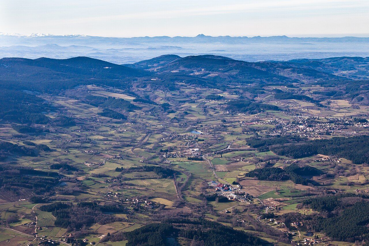
Noirétable sits on the southern edge of the Pays d'Urfé, at the meeting point of the Bois Noirs and the Monts du Forez. It is a hill town, larger than the surrounding villages, with a long tradition of crafts and small industry. From its high basin, the land rises south and west towards some of the wildest country in the Loire département: forested ridges and, beyond them, the open summit pastures known as the Hautes Chaumes.
A hill town in a high basin
The town lies in a wide, green basin at an altitude of roughly 700 m, surrounded by wooded slopes. Old routes between Lyon and Clermont-Ferrand pass nearby, and today the D1089 and the A89 motorway both cross the area, making Noirétable one of the more accessible places in the hills. Its streets, church and squares give it the feel of a small market town, and it makes a convenient base for exploring both the Pays d'Urfé and the Forez.
Seen from the air or from the surrounding heights, the basin is a patchwork of fields, hedges and scattered hamlets, with the Anzon stream winding through the valley and forests closing in on every side. The view gives a good sense of how settlement in these hills clusters in the sheltered hollows, leaving the high ground to woods and pasture.
The sanctuary above the town
Above Noirétable, on the wooded heights of the Bois Noirs, stands the sanctuary of Notre-Dame de l'Hermitage, a pilgrimage chapel set above 1,000 m. Pilgrims have climbed there for a long time, and it remains a place of devotion as well as a viewpoint. The site is reached by road or by walking paths through the forest, and on clear days the views take in the surrounding hills and the plains beyond.
The setting is quiet and wooded, typical of the high ground of the Bois Noirs. If you are walking, the climb from the town is a steady one; combine it with a loop through the forest for a satisfying half-day. The chapel is a place of worship, so dress and behave accordingly.
Up to the Hautes Chaumes
Turn the page: Into the Bois NoirsSouth of Noirétable, the Monts du Forez rise to their highest point at Pierre-sur-Haute, over 1,600 m. Above the tree line, the summits form a broad plateau of heath and grassland known as the Hautes Chaumes. The landscape is unlike anything else in the region: open, windswept and treeless, with heather, bilberry, peat bogs and wide skies.
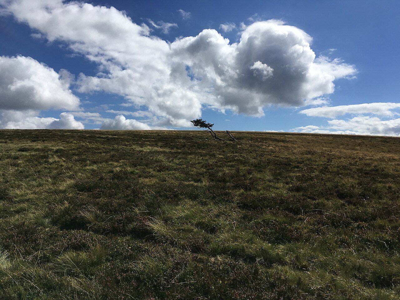
For centuries these high pastures were grazed in summer. Families moved their cattle up to the jasseries, stone buildings where they lived and made cheese during the grazing season. The tradition behind Fourme de Montbrison, described in our guide to Forez food, is closely tied to this way of life. Grazing has declined, and the heath has partly reclaimed the land, but the jasseries and the open plateau remain.
The Hautes Chaumes are fragile. Peat bogs and rare plants can be damaged by trampling, and parts of the area are protected. Stay on paths and tracks, keep dogs under control and leave plants and stones where they are.
The Col de la Loge, further south
Further south in the Monts du Forez, the Col de la Loge is a pass at about 1,250 m, known as a centre for outdoor activities. In winter, when snow allows, it is used for Nordic skiing and snowshoeing, and in summer the surrounding forests and pastures are popular for walking and mountain biking. It lies well beyond the Pays d'Urfé, but it is a natural extension if you are exploring the higher Forez.
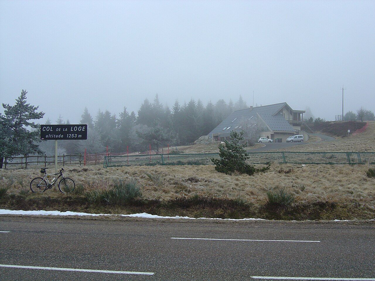
Facilities and activities depend on the season and on snow conditions. For snow closer to the Pays d'Urfé, see our guide to snow days in the hills.
Weather on the heights
The Hautes Chaumes and the high forests have a harsh climate. Wind sweeps the open plateau, fog can descend suddenly and temperatures are much lower than in the valleys. Even in summer, carry a windproof layer, a map and plenty of water, and be ready to turn back if visibility drops. In winter, deep snow and drifts can cover paths and markers, and the open ground offers no shelter.
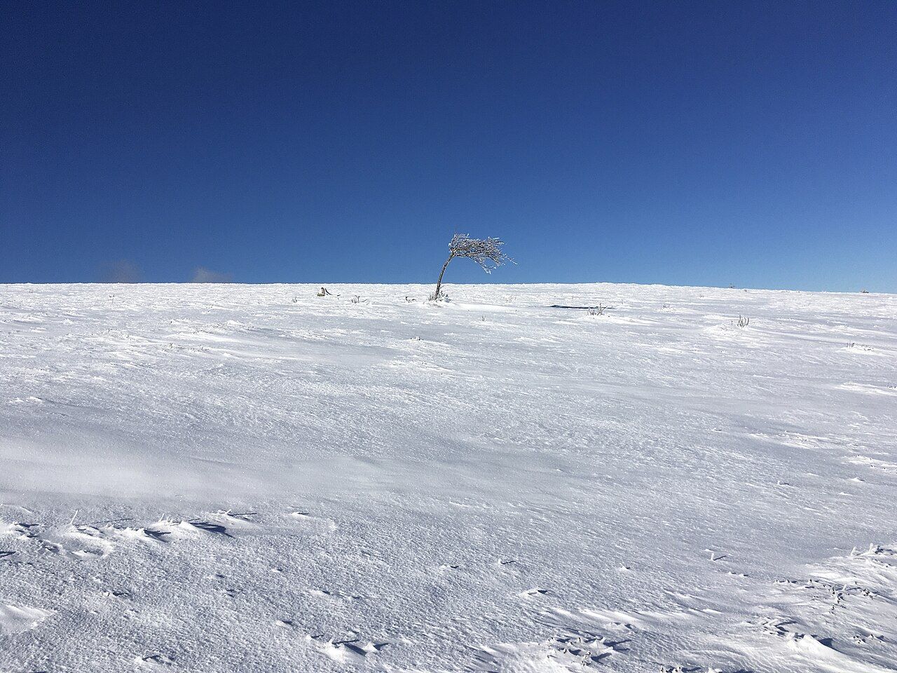
On a clear day, though, the rewards are huge. From the summits, the views can extend across the Forez plain and, in exceptional conditions, as far as distant mountain ranges on the horizon.
Linking Noirétable with the Pays d'Urfé
Noirétable is a natural gateway between the two areas. From the town, roads lead north towards Saint-Just-en-Chevalet and the villages of the Pays d'Urfé, and south-east down towards the Lignon valley and Boën. A day might combine a morning walk to the sanctuary, an afternoon drive to the high pastures and a return through the valley of the Lignon, tracing the river that runs from these heights down to the plain.
Whatever route you take, the contrast is the attraction: from the enclosed fields and forests of the Pays d'Urfé to the vast open tops of the Forez, all within a short drive.